SALITRAL
|
|
|
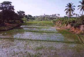
arrozal, paisaje típico de salitral |
|
UBICACIÓN
GEOGRÁFICA.- Se encuentra a 60 m.s.n.m. y tiene una ubicación geográfica de latitud sur 04º51’18’’ y una longitud oeste de 80º39’01’’. Salitral se encuentra en la margen derecha del río Chira, a medio camino entre Marcavelica y Querecotillo, unidos por una carretera que parte desde Sullana y llega hasta Lancones. Tiene 28.27 kms2 y una población de aproximadamente 6,000 habitantes. Sus centros poblados son: Pueblo: Salitral (capital). Caseríos Miraflores, Puerto Rico. Unidad agropecuaria: Cabo Verde Bajo, Dian, El Cortijo, Garay, La Hidráulica, Vista Florida. Salitral aparece en la historia desde la época pre-incaica, perteneció a la cultura tallán y en la época incaica era parte del Chinchaysuyo. En la conquista, Pizarro pasó por Salitral y se dirigió a Tangarará donde fundó la primera ciudad española en el Perú. Su fiesta de aniversario es el 19 de junio. La
dirección de la municipalidad distrital de Salitral es Av 27 de Octubre
202 y su teléfono 511092 CLIMA.-
Caluroso
en verano, con lluvias irregulares. En invierno es algo frío. El
paisaje de Salitral está pincelado de exuberante vegetación, donde
sobresalen los cocoteros y los extensos sembríos de platanales
|
GEOGRAPHICAL LOCATION.- Being 60 m.s.n.m. and with a geographical location of south latitude 04º51'18'' and a longitude west of 80º39'01''. Salitral is in the right riverbank of the river Chira, halfway between Marcavelica and Querecotillo, united by a highway that leaves from Sullana and it arrives until Lancones. With an extension of 28.27 kms2 and a population of approximately 6,000 inhabitants. Their populated centers are: Town: Salitral (capital). Villages Miraflores, Puerto Rico. Agricultural unit: Low Green end, Dian, The Farm, Garay, The Hydraulics, Vista Florida. Salitral appears in the history from the pre-Incan time, it belonged to the culture tallán and in the Incan time it was it leaves of the Chinchaysuyo. In the conquest, Pizarro went by Salitral and going to Tangarará where it founded the first Spanish city in the Peru. Their anniversary party is June 19. The address of the municipality of the district of Salitral is Av October 27 Nº 202 and its telephone 511092 CLIMATE. - In summer it is very hot, with irregular rains. In winter it is something cold. The landscape of Saltpeter is as drawn of exuberant vegetation, where the coconut trees and the extensive plantations of bananas stand out |
GEOGRAPHISCHE LAGE.- 60 m.s.n.m seiend. und mit einer geographischen Lage von Süden Breite 04º51'18'' und eine Länge westlich von 80º39'01''. Salitral ist Chira im richtigen Flußufer des Flusses, halb zwischen Marcavelica und Querecotillo, vereinigte neben einer Autobahn, die von Sullana geht, und es kommt bis Lancones an. Mit einer Vergrößerung von 28.27 kms2 und einer Bevölkerung von ungefähr 6,000 Bewohnern. Ihre besiedelten Zentren sind: Stadt: Salitral (Kapital). Dörfer-Miraflores, Puerto Rico. Landwirtschaftliche Einheit: Niedriges Grünes Ende, Dian, Der Bauernhof, Garay, Die Hydraulik, Aussicht Florida. Salitral erscheint in der Geschichte von das vor-Incan Zeit, es gehörte zum Kultur-tallán, und in der Incan Zeit war es, es geht vom Chinchaysuyo. In der Eroberung ging Pizarro von Salitral und das Gehen zu Tangarará, wo es die erste spanische Stadt im Peru gründete. Die Adresse von der Stadtgemeinde vom Gebiet von Salitral ist Av October 27 Nº 202 und sein Telefon 511092 KLIMA. - In Sommer ist es sehr heiß, mit unregelmäßigen Regen. In Winter ist es etwas kaltes. Die Landschaft von Saltpeter ist als gezogen von überschwenglicher Vegetation wo die Kokosnuß-Bäume und die umfangreichen Plantagen von Bananen-Einstellung aus |
|
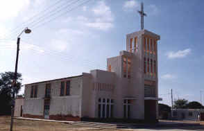
Templo Virgen del Carmen de Salitral |
|
|
|
Templo Virgen del Carmen de Salitral La
fiesta de mayor trascendencia es la de la Sociedad de la Virgen del
Carmen, que es considerada la patrona del pueblo y cuya imagen se
encuentra en el templo que lleva su nombre. Su día central es el 16 de
julio. Otra festividad es la de la Sociedad de la Santísima Cruz cuyo día
central es el 3 de mayo. En el recuerdo queda la fiesta que festejaba la
Sociedad de la Santísima Cruz de Coposito en dos fechas, el 31 de
diciembre donde se “quemaba” el año viejo y el 1º de enero para
celebrar el año nuevo. Cualquier vehículo de la ruta Sullana-Querecotillo necesariamente transita por Salitral.
|
I temper Virgin of the Carmen of Salitral The party of more transcendency is that of the Society of the Carmen's Virgin that the employer of the town is considered and whose image is in the temple that takes its name. Their central day is July 16. Another festivity is that of the Society of the Sacred Cruz whose day power station is May 3. In the memory it is the party that celebrated the Society of the Sacred Cruz of Coposito in two dates, December 31 where you “burned” the old year and January 1º to take place the new year. Any vehicle of the route Sullana-Querecotillo necessarily traffics for Salitral |
Ich mildere Jungfrau vom Carmen von Salitral Die Partei von wichtiger ist das von der Gesellschaft von der Carmen Virgin das der Arbeitgeber der Stadt betrachtet wird, und wessen Bild ist im Tempel, der seinen Namen nimmt. Ihr zentraler Tag ist der 16. Juli. Noch ein Fest ist das von der Gesellschaft vom Heiligen Cruz, wessen Tag-Macht-Station der 3. Mai ist. Im Gedächtnis ist es die Partei, die die Gesellschaft vom Heiligen Cruz von Coposito in zwei Daten feierte, der 31. Dezember wo Sie “brannte” das alte Jahr und Januar 1º, Stelle das neue Jahr zu dauern. Irgendein Fahrzeug der Strecke Sullana-Querecotillo notwendigerweise Verkehre für Salitral |
|
|
|
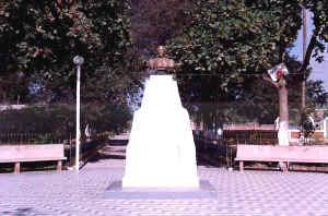
plaza de salitral |


