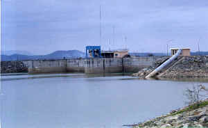
LANCONES
|
|
|
UBICACIÓN
GEOGRÁFICA El
distrito de Lancones se encuentra a 120 m.s.n.m. y con una ubicación
geográfica de latitud sur 04º34’27’’ y de latitud oeste 80º28’24’’
Tiene una extensión de 2,189.35 kms2 y aproximadamente
12,000 habitantes. Su territorio limita con Ecuador CLIMA En
verano tiene un máximo de 35ºC y un mínimo de 30ºC. En invierno las
temperaturas oscilan entre 20 y 26ºC. La represa ha creado un
microclima en la zona lo
que motiva neblina en épocas de invierno
|
GEOGRAPHICAL LOCATION The district of Lancones is to 120 meters on the level of the sea and with a geographical location of south latitude 04º34'27 ' ' and of latitude west 80º28'24 ' ' Has an extension of 2,189.35 square kilometers and approximately 12,000 inhabitants. Their territory limits with Ecuador CLIMATE In the summer station the temperature oscillates between a maximum of 35ºC and a minimum of 30ºC and in winter between 20 and 26ºC. It dams it it has created a small climate in the area what motivates fog in winter times |
GEOGRAPHISCHE LAGE Das Gebiet von Lancones ist zu 120 Metern auf dem Niveau des Meeres und mit einer geographischen Lage von Süden Breite 04º34'27 ' ' und von Breite West 80º28'24 ' ' hat eine Vergrößerung von 2,189.35 quadratischen Kilometern und ungefähr 12,000 Bewohnern. Ihr Territorium begrenzt mit Ekuador KLIMA In der Sommer-Station schwingt die Temperatur zwischen einem Maximum von 35ºC und einem Minimum von 30ºC und in Winter zwischen 20 und 26ºC. Es staut es, es hat ein kleines Klima im Gebiet das geschaffen, was Nebel mal in Winter motiviert, |
