MIGUEL CHECA
|
|
|
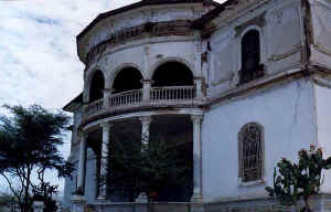
El distrito de Miguel Checa se encuentra ubicado a la margen izquierda del río Chira, aproximadamente a 15 km de la ciudad de Sullana, por la vía a Paita y sus coordenadas geográficas son, latitud sur 06º53’48’’ y longitud oeste 80º48’45’’. Se encuentra aprox. A 70 m.s.n.m. La capital del distrito de Miguel Checa es el pueblo de Sojo. Tiene
una superficie de 450.30 km2.
El terreno es ligeramente ondulado,
presentándose en algunas partes depresiones originadas por los fenómenos
naturales que se presentan en la zona, como las lluvias. Esta estructura
corresponde a la morfología de la costa. Los centros poblados de Miguel Checa son: Sojo (capital). Caseríos: Chalaco, Lucas Cutivalú, Miguel Checa, Jíbito CLIMA.-
Es mas bien cálido y seco. En el mes de noviembre, por las tardes,
presenta un regular viento en dirección sur a norte. Su temperatura
media anual es de 14ºC y una temperatura máxima media anual de 24ºC.
La humedad relativa anual oscila entre 65% y 67%. POBLACIÓN.- 5,720 habitantes. 3,700 electores |
The Miguel Checa district it is located to the left riverbank of the river Chira, approximately to 15 km of the city of Sullana, for the road to Paita and its geographical coordinates are, south latitude 06º53'48'' and longitude west 80º48'45''. being approximately to 70 m.s.n.m. The capital of Miguel Checa district it is the town of Sojo. With a surface of 450.30 km2. The land is something wavy, being presented in some parts depressions originated by the natural phenomenons that are presented in the area, as the rains. This structure corresponds to the morphology of the coast. The Miguel Checa populated centers they are: Sojo (capital). Villages: Chalaco, Lucas Cutivalú, Miguel Checa, Jíbito CLIMATE. - it is but very warm and I dry off. In the month of November, in the afternoons, it presents a regular wind in south address to north. Their annual half temperature is of 14ºC and an annual half maximum temperature of 24ºC. The annual relative humidity oscillates between 65% and 67% . POPULATION. - 5,720 inhabitants. 3,700 voters
|
Der Miguel Checa Gebiet, das es zum linken Flußufer des Flusses Chira gefunden wird, ungefähr zu 15 km von der Stadt von Sullana, für die Straße zu Paita und seinen geographischen Koordinaten ist, Süden Breite 06º53'48'' und Länge West 80º48'45''. das Sein ungefähr zu 70 m.s.n.m. Das Kapital von Miguel Checa Gebiet, das es die Stadt von Sojo. Mit einer Oberfläche von 450.30 km2. Das Land ist etwas welliges, was präsentiert in einigen Teile-Depressionen von den natürlichen Phänomenen, die im Gebiet präsentiert werden, als die Regen, hervorgebracht wird. Diese Struktur entspricht der Morphologie der Küste. Der Miguel Checa besiedelte Zentren, die sie sind,: Sojo (Kapital). Dörfer: Chalaco, Lucas Cutivalú, Miguel Checa, Jíbito, KLIMA. -es ist, aber sehr warm und ich trockne. Im Monat November, an den Nachmittagen, präsentiert es ein regulär winden Sie in nach Süden Adresse zu Norden. Ihre einjährige Pflanze, die Hälfte Temperatur von 14ºC und einer jährlichen halbe maximalen Temperatur von 24ºC ist. Die jährliche verhältnismäßige Luftfeuchtigkeit schwingt zwischen 65% und 67% . BEVÖLKERUNG. -5,720 Bewohner. 3,700 Wähler |